Geography
Located in the northern Caribbean basin, the Greater Antilles (Figure 1) consists of the islands of Cuba, Jamaica, Puerto Rico, and Hispaniola (Haiti and the Dominican Republic). The Bahamas archipelago consists of the Commonwealth of the Bahamas and the Turks and Caicos, BWI. Cuba, Hispaniola, Jamaica, and Puerto Rico, the Caribbean’s largest, oldest, most geologically complex, and most physiographically and environmentally diverse islands, are characterized by topographically varied landforms created by metamorphic, volcanic, and sedimentary activity. In contrast, the Bahama archipelago is made up of a series of low-lying carbonate islands composed of Pleistocene and Holocene eolianite ridges and swales formed by sedimentary processes.
Climatically, the area is characterized as the subtropics. The greatest amounts of precipitation fall June-November, coinciding with the hurricane season. Dry seasons occur February-March and in May. Precipitation varies greatly. More precipitation falls on the islands’ higher elevations and the northern and eastern sides; the southern and western sides, and the mountains’ leeward side receive less precipitation (rain shadow effect). In Hispaniola the mean rainfall varies between 1000 and 5000 mm, whereas in the Bahama archipelago mean rainfall ranges from 350 to 1250 mm. There is little annual change in mean air temperature. Diversity in vegetation is attributed to latitude, elevation, rainfall amounts and seasonality, topography, and edaphic conditions. There are 13 life zones ranging from tropical desert scrub to subtropical rainforest; the dry forest life zones dominate. Marine (beach, intertidal, reef, deep-water) environments support shellfish, fish, marine mammals, and turtles. Estuaries serve as marine fauna nursery grounds. Terrestrial environments support mammals, reptiles, invertebrates, and amphibians. Birds inhabit a variety of habitats.
Time-Space Systematics
Caribbean archaeologists use different schemes to name, classify, and systematize the temporal, spatial, and cultural relationships of the prehistoric people they study. The most widely used system was conceived by Irving Rouse who created it to chart the migratory routes and culture histories of the people who colonized the Caribbean. In his system, prehistory is divided into periods; each period is characterized by archaeological cultures defined by lithic or ceramic assemblages grouped on the basis of shared traits (see Time and History, Divisions). In an assemblage, the most inclusive cultural unit is the series (designated by - oid), which is divided into a subseries (designated by - an). The minimal unit is the style, which represents a local expression of a subseries. The style is typically named for the first site in which it was
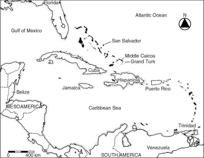
Figure 1 Map of the Greater Antilles and the Bahamas archipelago. Courtesy of Perry L. Gnivecki.
Found and described. Critics believe the system simplifies and obfuscates the range and sources of cultural variation present in the archaeological record. Cuban archaeologists use an evolutionary scheme based on stages consistent with Marxist cultural materialism (see Marxist Archaeology). Chanlatte Baik has developed a system for Puerto Rico, while Dominican archaeologists employ one based on local sequences.
 World History