Intensive agriculture frequently involves the construction of landscape architecture such as field walls, terraces or lynchets, raised or ridged field features, and irrigation systems (e. g., canals, aqueducts, wells, water storage features) (Figure 1). These features enclose natural land, aid crop production, and engender land tenure. Field boundaries may appear in political and property maps and, as they are frequently maintained for generations, historical maps may identify archaeological fields in regions with long agricultural histories.
Aerial photography and satellite imagery capture landscape architecture where it is still standing or is near the surface and modern vegetation is minimal (Figure 2). Remote sensing (e. g., ground-penetrating radar, magnetrometry) can identify subsurface field systems, particularly buried field walls and irrigation features. Geological and soil maps help evaluate natural resources. The value of these proxy records should be evaluated through reconnaissance and survey of actual field systems on the ground. Geographical information systems (GISs) are employed to integrate these multiple spatial data sets, speed mapping of landscape architecture, and calculate the cultivated area.
Irrigation systems rely on natural rainfall and hydraulic patterns, which should underpin their archaeological investigation. Changing water tables and tectonics may complicate the reconstruction of irrigation systems and need to be addressed in field investigations. Abandoned irrigation features can be excavated to help deduce why they failed (e. g., gradual silting up, catastrophic infill). In a study that critically applies many of the methods highlighted here, Tony Wilkinson (2003) investigated Near Eastern agricultural landscapes and the role of irrigation. Divergent agricultural adaptations were identified in the rain-fed northern uplands and the irrigated fields of southern Mesopotamia. Reflecting the role of agriculture in complex polities, this study provided insight into different configurations of community organization, political inequality, and authority systems. This exemplifies the potential contribution of field system research to central questions in archaeology.
The identification of extensive agriculture (i. e., swidden or slash-and-burn) provides a greater challenge to archaeologists. Scarce landscape architecture
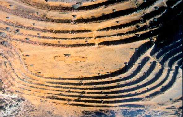
Figure 1 Inca terraces at Moray, Peru.
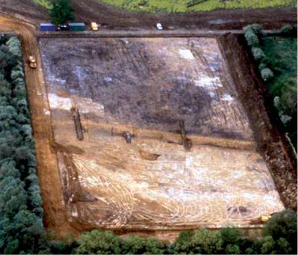
Figure 2 Aerial photograph of a Later Bronze Age field with plaggen A horizon defined by dark soil mark at Welland Bank Quarry, south Lincolnshire, UK. Copyright Charles A. I. French.
Limits the utility of aerial images and maps. Short occupation may leave little trace on the soil. When abandoned, extensive fields may blend into the surrounding uncultivated ecology. In some instances, burning and fertilization alter vegetation and soils aiding in identification. In other instances, rare constructed features within areas of swidden cultivation support the identification of cultivated areas.
 World History