Traditional archaeological aerial reconnaissance has involved selective oblique photography of sites identified by observation from light aircraft flying at a height of less than 2000 ft (e. g., Figures 1-3 and 5). There is an ongoing debate, however, about the need for more extensive vertical block coverage specifically for archaeological purposes so as to maximize recovery rates and better facilitate the process of producing detailed site plans from the photographs.
The vast bulk of aerial photography, however, is not taken to aid the discovery of archaeological sites, but for mapping or landscape monitoring purposes. This is generally vertical photography taken from a much greater height, usually 15 000-20 000 ft or more. But,
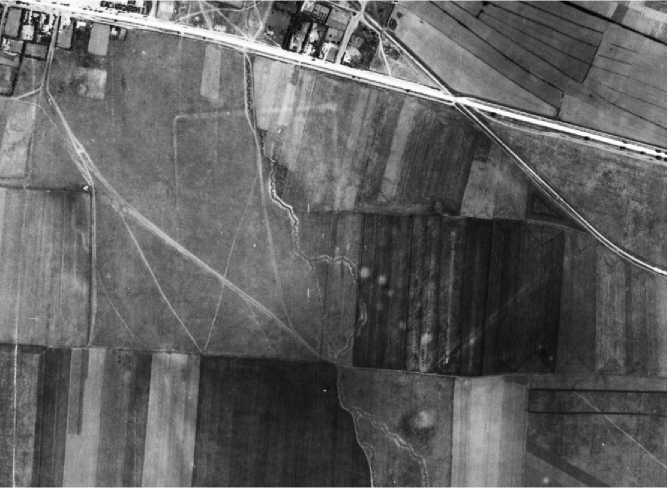
Figure 6 Roman fortification (now destroyed by housing) and adjacent burial mounds near Constanta, Romania, visible on Second World War military reconnaissance photography. Copyright: The Aerial Reconnaissance Archives, University of Keele.
Since the principles by which archaeological sites are revealed are in no way dependent on the mode or scale of photography, any existing aerial photography has the potential to record sites if it has been taken at the right time of year and in favorable conditions. Thus, archives of existing photography can also be consulted in the search for sites, especially where they may have been destroyed or badly damaged subsequently. The potential of those archives which hold historical photography, such as the Aerial Reconnaissance Archive at the University of Keele in England, which contains coverage of large areas of Europe obtained during World War II, has yet to be fully exploited (Figure 6).
 World History