Estimating pre-modern population numbers and densities is notoriously difficult and fraught with dangers, methodological and factual, so while the distribution of settlement and settlement densities represented in Maps 1.5-1.8 give a reasonably accurate picture of the proportions between different areas of the empire, the numbers suggested below for mean population levels must be taken with a considerable degree of caution, however credible they may appear to be. On the whole, I have erred on the cautious, but even here exactitude is impossible.
The climatic and geographical features which determined land-use likewise determined where populations were concentrated and how many people the land could support. The degree of continuity from medieval to modern times is, in this respect, considerable. But there were within our period very considerable fluctuations, both in respect of the relationship between the populations of urban and rural regions, on the one hand, and in terms of their density. Broadly speaking, there appears to have been a long downward curve in population during the late Roman period, reaching a nadir in the later seventh and eighth centuries, followed by a slow recovery into the later ninth and tenth centuries, with a fairly dramatic rise in the twelfth century. It has been estimated that the population of Roman Europe (including Britain and the Balkan provinces) was in the order of approximately 67-70 million at the end of the second century CE, falling to around 27-30 million by the early eighth century, rising again by 1300 to some 73 million, with a particularly noticeable rise about 1200 CE. All the evidence suggests a similar curve in the near eastern and - in the later centuries - Islamic world, and these accord with the minor climatic changes described above. The catastrophic slump of the mid-fourteenth century, which saw the population of Europe drop to somewhere in the region of 45 million, was made good within a century. While these figures are necessarily crude approximations, in view of the nature of the available sources and the problems of their interpretation, and while one can point to a number of exceptions, quite apart from a differential rate of change from east to west, and including important regional and local variations, they seem now generally agreed, at least in their broad outlines. The most recent estimates for the late Roman and Byzantine areas propose a population for the empire’s eastern provinces, of some 19-20 million just before the middle of the sixth century (before the plague of the 540s), with a further 7 million in the west; of 17 million in the early seventh century, with a reduction to about 7 million by the middle of the eighth century, and a gradual rise to about 10 million in the mid-ninth century, 12 million by the time of Basil II, falling again to about 10 million (after the loss of central Anatolia to the Turks) in the mid-twelfth century, 9 million in the early thirteenth century, 5 million by about 1280 and a consistent downward trend thereafter as the empire’s territorial extent was reduced. Slightly higher figures for the tenth to twelfth centuries have also been proposed, with a population of some 18 million in the 1020s, for example. All can be challenged on various grounds, but they provide some very crude totals in respect of the amount of agrarian produce consumed and available for, for example, the support of armies or similar transient population groups.
Given the geographical constraints described already, it is apparent that the pattern of settlement, and in particular the density of settlement, will reflect this environment very closely, and this is indeed the case both in modern times as well as in the pre-modern and pre-industrial world. A comparison of the areas of settlement density as reflected in the presence of cities (as defined in the Roman legal context) in the late Roman and early Byzantine world with one showing modern demographic patterns demonstrates a remarkable continuity in both the Balkans and Anatolia. Such a map can tell us little about absolute numbers, of course, nor about the fluctuations across time in density and extent of settlement; but it does point to the relationship between human populations and the ability of the land to support them. A glance at the demographic situation in Turkey before the Second World War (representing the mid-1930s) shows this relationship quite clearly (Map 1.8). A map showing the density of Roman cities and Byzantine Episcopal sees highlights the fact that it is more or less the same areas which could maintain substantial populations in ancient and medieval times, which saw the densest concentration of urban centres, and which may thus be taken to have remained the most productive and heavily-settled regions of the Byzantine period after the transformation of the late ancient city network after the seventh century. A similar pattern emerges from a comparison of Roman and medieval population centres with
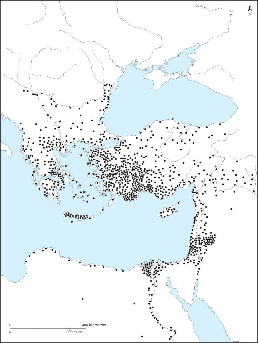
Map 1.5 Major population centres c. 500 CE. (After Jones, Cities of the Eastern Roman Provinces.)
200 kilometres 100 miles
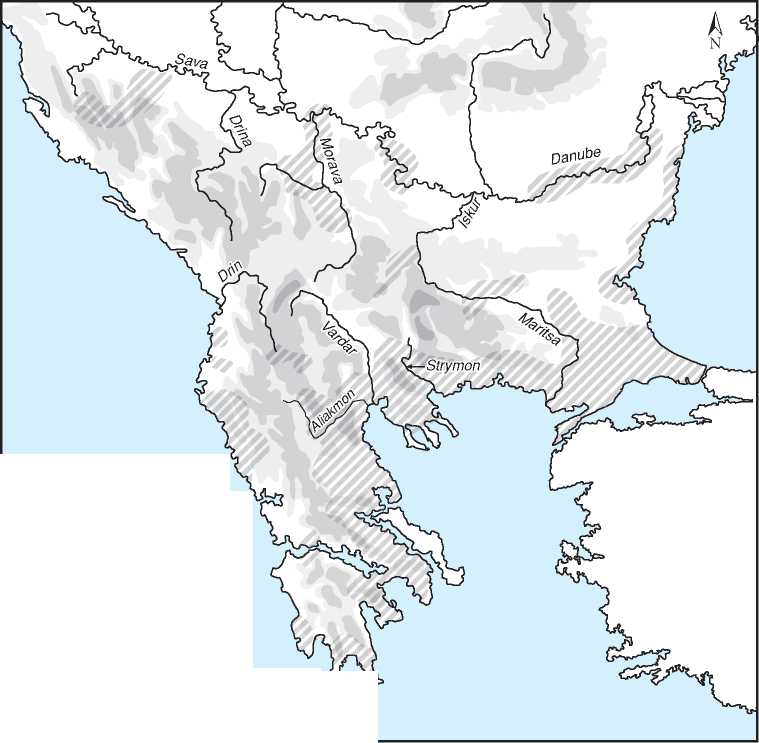
I I Most densely populated regions tr’
Map 1.6 The Balkans: major population centres, 7th-12th centuries.
 World History