A major part of the success of the landings can be explained by the inefficiency of the German Intelligence services. Here the Nazis Kaltenbrunner and Schellen-berg, who had ousted the professionals Canaris and Oster, could neither get a clear idea of the British and American plans nor escape being deceived by the Allies’ diversionary manoeuvres. Therefore hypotheses were the order of the day
I
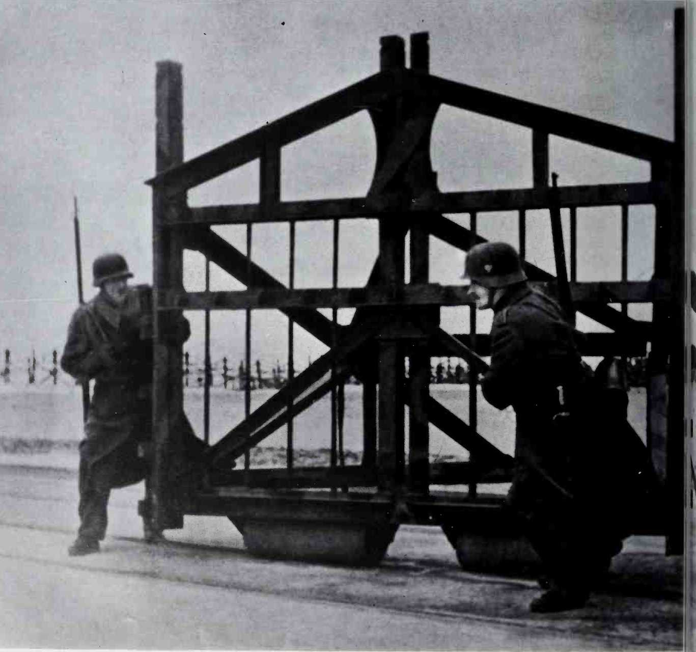
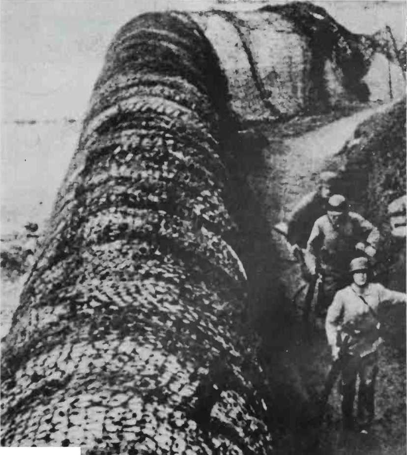
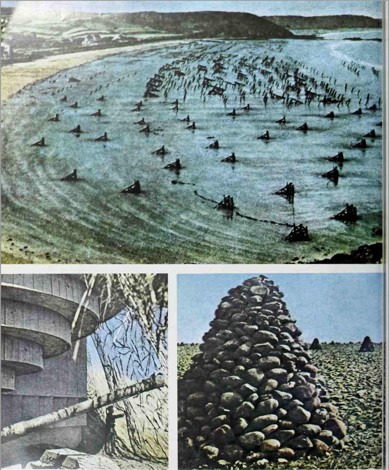
V Wheeling a "Belgian Gate” into position on the foreshore-a massive construction of angle-iron designed to disembowel landing-craft. There were other unpleasant surprises, too-but never enough of them to satisfy Rommel.
> V Like an outsize concrete bolster-a tank trap doubling as a parapet for the infantry behind.
At O. K.W. as well as Saint-Germain-en-Laye, headquarters of Western Command (O. B.W.) and la Roche-Guyon, headquarters of Army Group ”B”.
Hitler had given a long analysis on the situation on March 20. Though he recognised that there was no way of being sure in which area the Allies would land, over the whole coastline from Norway to Greece, he nevertheless made his point:
"At no place along our long front is a landing impossible, except perhaps where the coast is broken by cliffs. The most suitable and hence the most threatened areas are the two west coast peninsulas, Cherbourg and Brest, which are very tempting and offer the best possibilities for the formation of a bridgehead, which would then be enlarged systematically by the use of air forces and heavy weapons of all kinds.”
This hypothesis was perfectly logical and the order of battle of the German 7th Army (Colonel-General Dollmann), was correctly arranged to face this possibility. Of its 14 divisions, 12 were deployed between the Rivers Vire and Loire.
Rundstedt did not share Hitler’s opinion, and considered that there were a great many more advantages from the Allied point of view for them to cross the Channel and land in the Pas-de-Calais. Later, in 1945, he supported his views by using these arguments, according to Milton Shulman:
"In the first place an attack from Dover against Calais would be using the shortest sea route to the Continent. Secondly, the V-1 and V-2 sites were located in this area. Thirdly this was the shortest route to the Ruhr and the heart of industrial Ger
Many, and once a successful landing had been made it would take only four days to reach the Rhine. Fourthly, such an operation would sever the forces in Northern France from those along the Mediterranean coast. Against the Pas-de-Calais being chosen was the fact that this area had the strongest coastal defences, and was the only part of the Atlantic Wall that even remotely lived up to its reputation. I always used to tell my staff that if I was Montgomery 1 would attack the Pas-de-Calais.”
But this would have meant coming up against the strongest part of the Atlantic Wall, whose concrete-housed batteries on either side of Cape Gris-Nez kept the English coast between Ramsgate and Dungeness under the fire of their 14 11-, 12-, 15-, and 16-inch guns; also Colonel-General von Salmuth’s 15th Army was well deployed in the area, with 18 divisions between Antwerp and Cabourg. These troops were of good quality, and so it would seem that at O. K.W. Field-Marshal Keitel and Generals Jodi and Warlimont expected a landing between the mouths of the Rivers Somme and Seine, outside the range of the heavy artillery mentioned above but still within the 15th Army’s sector, under the overall command of Field-Marshal Rommel.
T7
 World History